Leveraging technology to improve roadway and work zone safety in Nevada
By: M.J. Maynard
An estimated 2.3 million people call Southern Nevada home with approximately 50,000 new residents moving to Clark County every year.
As a result, the roads are busier than ever to the tune of 9 million trips daily. The Regional Transportation Commission of Southern Nevada (RTC) is capitalizing on emerging technologies to adapt to the growing pains of the Las Vegas Valley, with road safety as its top priority. Inevitably, growth has led to more traffic congestion and road construction, both sometimes resulting in automobile crashes. In an effort to prevent collisions and reduce congestion, the agency’s Traffic Management Center has actively tested technological advances for the past few years along Southern Nevada’s busiest interstate. As the RTC continues to leverage technology to improve roadway safety on freeways, the agency is engaging in a first-of-its-kind effort to bring the same results to work zones.
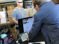
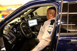
The RTC, together with the Nevada Highway Patrol (NHP) and Nevada DOT (NDOT), launched an artificial intelligence (A.I.) project on one of the busiest sections of I-15 with technology company Waycare in 2018. Waycare’s A.I. platform and real-time data analysis enables detection of significantly more traffic crashes, facilitating faster validation and reducing emergency response times. Typically, law enforcement or drivers would have to call in a crash. Waycare eliminates the gap between dialing 911 or 311 and dispatching help. When every second counts, Waycare reports crash locations in real time. This is done by analyzing data from a variety of sources, including in-vehicle navigation devices, roadside traffic detectors, the Waze app, and other telematics providers. In fact, Waycare’s technology is expected to generate more data than all road sensors generate in Las Vegas today.
Seeing results
In Southern Nevada, the results of utilizing Waycare’s advanced technology are impressive. Waycare has uncovered 20% more crashes than previously reported. Waycare has also enabled the RTC and its law enforcement partners to reduce response times to crashes on average by nine to 10 minutes. The faster emergency crews arrive on scene, the faster vehicle occupants can get help, which ultimately helps to prevent traffic jams and mitigate the likelihood of injury leading to fatality.
Waycare’s technology also combines real-time data with predictive analytics to help identify areas at high risk for a collision, dangerous driving conditions, and traffic congestion. This insight enables NHP to proactively deploy traffic patrols and abatement efforts more efficiently with the goal of preventing crashes, reducing speeding, and increasing safety. For the first time, there is an objective understanding based on data—instead of anecdotal references—about what stretches of roadway are prone to crashes and in need of abatement measures.
During the pilot, the emerging technology identified a 6-mile segment of I-15 as a high-risk area. Consequently, NHP focused its preventative measures and patrols in this stretch of road. As a result, 91% of drivers traveling over the speed limit of 65 miles per hour reduced their speed to below the speed limit, simultaneously reducing the number of primary crashes by 17%.
Numbers do not lie
The results of this testing phase prove that A.I. has a dramatic impact on improving safety even on our busiest freeways. Stemming from these findings, the RTC is once again partnering with NHP and NDOT to expand its study area. Through a grant from the National Safety Council’s Road to Zero initiative, the RTC deployed five additional Strategic Traffic Management Sites (STMS) in October 2019. STMS provide law enforcement with elevated, protected platforms in visible locations, coupled with specific messaging on dynamic message signs (DMS) along enforcement corridors. This encourages drivers to slow down on Southern Nevada’s high-risk urban corridors on I-15 and U.S. 95, as identified by the A.I. technology.
After three successful years, the RTC and Waycare expanded its program in January 2020 to create the largest integration of connected vehicle data in the nation. Through new partnerships with multiple smart mobility firms, Waycare will now obtain and analyze data from thousands more connected vehicles. The data will look at driving behavior, intersection wait times, location, and speed. This additional information will further enhance the RTC’s ability to effectively investigate causes of roadway crashes, reduce congestion and secondary crashes, and deploy preventative actions.
Smart work zones reduce congestion and improve safety
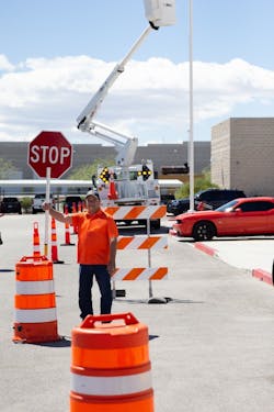
Given the proven efficacy of Waycare’s A.I. platform, the RTC is engaging in a first-of-its-kind effort to reduce traffic congestion and improve safety in and around road construction. The agency is testing various technologies, such as Nexar, iCone, and HAAS Alert, to detect work zones in real time. This allows them to broadcast the location of static barricade equipment—including cones, barrels, and signs—as well as construction vehicles and workers.
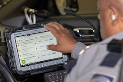
This insight feeds into the Waycare platform to inform first responders and law enforcement to support their roadside response efforts. In addition, some of the technologies feed into popular traffic apps like Waze and the RTC’s own traffic alert email and text message system to help motorists know what is ahead on their trip.
For example, the RTC has been testing and recently expanded Nexar CityStream, which gathers data to improve traffic conditions and safety in and around road construction zones. Nexar’s A.I.-based detection program crowdsources information about temporary traffic control devices such as cones and barricades in construction work zones and other road obstructions. This helps to mitigate congestion and reduce the possibility of traffic collisions.
Nexar’s platform uses dashcams in private vehicles, taxis, and transportation network vehicles like Uber and Lyft to look for temporary traffic control devices and road obstructions from a driver’s perspective. The dashcams provide anonymous real-time data on the status of hundreds of temporary traffic control devices. The footage allows Nexar to then analyze the effect on traffic: location, date, time, number of traffic lanes affected, and a video frame image of the detected activity. In addition, Nexar can report near-miss collisions or harsh braking situations—safety issues that previously were never recorded or monitored for causation trends and secondary effects.
The pilot with Nexar began in a 3-sq-mile area in downtown Las Vegas and now includes a total of 9 sq miles in both the cities of Las Vegas and Henderson. Since its launch in December 2018, Nexar-connected vehicles are logging approximately 800,000 miles within the Las Vegas Valley each week.
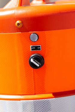
Another technology piloted by the RTC is iCone traffic control beacons. Currently, 40 of these state-of-the-art beacons are installed on cones, drums, and arrow boards, broadcasting their locations from inside the work zone to the traveling public through the Waze traffic app.
Similarly, the RTC has partnered with HAAS Alert to install its devices which broadcast, via the Waze app, the location of construction vehicles, equipment, and workers within active construction zones. The goal is to alert traffic engineers and the traveling public of work zones along a route. As of January 2020, there are 12 HAAS Alert devices on fleet vehicles, including bus stop maintenance crews.
By providing roadway construction information from these technologies via the popular Waze app, the RTC empowers the public with more knowledge as they plan their commute. With more real-time information, drivers can consider alternate routes to avoid a crash or road construction, helping reduce congestion and the possibility of secondary traffic collisions.
Nexar, iCone, and HAAS Alert have been tested actively in the field by the RTC for more than a year. To expand its efforts, beginning this year Southern Nevada jurisdictions seeking funding from the RTC for a roadway maintenance or improvement project will be required to use any combination of these devices to improve traffic operations and ultimately increase roadway safety in and around the congested areas created by road construction.
As we enter a new decade, advanced transportation technologies will continue to evolve, enabling traffic management agencies like the RTC to further enhance its efforts to improve roadway safety, taking an innovative leap in testing out new technology, not knowing what would be learned. To say the lessons learned are significant is an understatement. Technology is literally reshaping every facet of how we address roadway safety. The agency’s ambition to explore and enter unchartered territory is what led to start-up companies that have produced positive results. As we continue to discover how technology can keep our growing region moving safely on the road, the RTC remains committed to aggressively pursuing new opportunities in technological advances.
About The Author: Maynard is CEO of the Regional Transportation Commission of Southern Nevada.
