Digital Design and Safety
By Brad Dennard, Contributing Author
The following story outlines a project that won at Bentley’s 2023 Going Digital Awards in Infrastructure in the Roads and Highways category. The awards were announced at Bentley’s Year in Infrastructure conference in Singapore in October.
For years, Interstate 70 has been an essential gateway to the Rocky Mountains for adventurers, vacationers, and sightseers in Colorado. This east-west highway climbs over and through narrow mountain passages. Yet few stretches on this interstate are as frustrating as the Floyd Hill segment between Evergreen and Idaho Springs.
A familiar bottleneck to travelers, it has been described as the “waist of an hourglass,” where three lanes shrink to two along a 6% grade. This stretch of road also weaves through a narrow canyon, while connecting to the always busy U.S. Route 6 (U.S. 6).
It’s estimated that some 70,000 vehicles drive on this highway each weekend.
Many of the corridors’ existing roadway elements are inadequate for today’s traffic volume and travel speeds. This section of I-70 has not had significant improvements since its original construction in the 1960s, according to the Colorado Department of Transportation (CDOT).
The result: A less than optimal safety condition for vehicles.
These roadway elements include narrow shoulders, tight horizontal curves, reduced sight distance, and outdated roadside barriers.
Several years ago, CDOT initiated the I-70 Floyd Hill project, a $700 million, multi-year effort to reconstruct this 7-mile stretch of highway.
The Floyd Hill project is facilitated through a construction manager/general contractor (CMGC) procurement. The challenge for AtkinsRéalis, the lead designer and engineer-of-record, was to improve safety, mobility, operations, and maintenance, minimize construction and economic impacts, gain stakeholder commitment and partnership, and enhance environmental stewardship.
Rethinking this corridor was a study of intense coordination, communication, and creativity. It also was an opportunity to use the team’s specialized 3D optioneering expertise, which was facilitated by an engineering-quality digital twin prototype—a virtual replica of Floyd Hill’s existing and future conditions. The digital twin prototype continues to provide value to the customer, the contractor, and various stakeholders as construction ramps up on this critical project.
A Model for Modification
Alternatives for corridor improvements were broad and comprehensive. Key components included the addition of a westbound express lane, an eastbound climbing lane, new bridges, and an improved interchange and frontage road access to U.S. 6, as well as wildlife passageways, air quality monitoring stations, and the full reconstruction of a nearby trail.
Early on, the AtkinsRéalis team developed a virtual representation of the highway along the Floyd Hill corridor. Initially, the team used site surveys to generate a model of existing conditions. Aerial imagery on top of that model provided additional context. That early model became the foundation for initial environmental assessments as well as studies to determine right-of-way impacts.
Once developed, the engineering team could use the data to prepare and evaluate design alternatives. Bridges, foundations, abutments, and walls were analyzed, designed, and modeled utilizing parametric bridge modeling software. The results were then coordinated with specialized design modeling software and overlaid on top of the existing conditions model.
The combination of solutions, including model-centric engineering design software and real-time visualization software, helped the team quickly evaluate and envision impacts and improvements to driver safety, construction and the environment, quantities, cost, and constructability helping to narrow down alternatives that best met the project goals.
Those same engineering models proved invaluable because they became a foundation for communication to the non-engineering community.
Virtual and Visual Forum
As expected on a high-profile project such as Floyd Hill, the job communicating with CDOT, stakeholders and the public with a forum. It was crucial for everyone involved to understand and evaluate various alternatives.
With modern technology, the team generated visual imagery directly as a by-product of the engineering model—it's no longer a separate task.
The team created visualizations, fly-through videos, and 360-degree virtual reality images, directly within that singular environment. In essence, the Floyd Hill team has a continually updated model of the proposed design at any given point in time superimposed over existing conditions.
Collaboration with a large, multi-regional, diverse, internal design group (190 design and modeling experts from 10 offices), as well as external consultants and stakeholders including the contractor, during the design process has been critical to the design of the Floyd Hill project.
Throughout the evaluation of alternatives, designers, and engineers updated alignments and reprocessed the model on demand to communicate with stakeholders and the client.
A Zig, a Zag and a Long Viaduct
Ultimately, CDOT selected the canyon viaduct alternative for the Floyd Hill project. The same digital twin prototype that was used to evaluate alternatives would be used to refine the design concept with an eye to construction safety/accessibility, environment, and aesthetics.
The larger project is broken up into three sections: east, central and west.
The east section spans from County Road 65 to the bottom of Floyd Hill. Construction includes the addition of a westbound express lane that will connect with the existing westbound Mountain Express Lane. This increases traffic capacity and eliminates the existing bottleneck.
An eastbound I-70 climbing lane will be constructed from a new U.S. 6 ramp to eastbound I-70 to allow heavy commercial or slow-moving vehicles to scale the long, steep grade of Floyd Hill separate from the general travel lanes.
The west section spans from the Central City Parkway interchange to Idaho Springs. Construction will include the continuation of the new express lane on westbound I-70. This will flatten I-70’s curves to improve safety by increasing design speed and sight distance. Bridges over Clear Creek will be rebuilt, and the Clear Creek Greenway trail will be resurfaced.
The central section is the most complicated. It extends from the bottom of Floyd Hill to Central City Parkway.
It is largely located within a canyon that has been cut over thousands of years by the Clear Creek—a popular recreational area, with a multi-use path that runs alongside the waterway. This phase will include the construction of seven new bridges.
One of those new bridges is the I-70 westbound viaduct. Building this bridge will address one of the most critical safety concerns on the project.
In the existing condition, there is a narrow, substandard curve with insufficient sight distance at the bottom of the long, steep grade of Floyd Hill. This condition causes significant traffic congestion, especially during adverse weather conditions.
The new viaduct realigns westbound I-70 with a flatter curve and wider shoulders for increased travel speed and sight distance.
Along with the added capacity of the express lane on the viaduct, this will significantly increase the safety of the traveling public. Other features include construction of a new frontage road connection between the U.S. 6 and Central City Parkway interchange, a new on-ramp to eastbound I-70 from the bottom of Floyd Hill/U.S. 6 and reconstruction of the Clear Creek Greenway trail.
A CDE of Efficiency
The digital twin prototype would once again prove essential to interdisciplinary coordination, external stakeholder workshops, and contractor design review.
By using the models generated from standardized workflows in design solutions, the team identified, and formally resolved, interface points between disciplines. The use of integrated design review tools allowed the team to mirror a five-step QC process that includes customized forms, notification to reviewers and task leads, and tracking of the closure of comments from previous milestone submittals.
To accomplish this level of real-time coordination, project collaboration software was utilized as the common data environment (CDE). Within the CDE, the team developed a fully managed workspace to ensure compliance with CDOT CADD criteria and to ensure consistency through all the design files.
Through the CDE, all relevant design, engineering and construction professionals visualized and navigated critical infrastructure data (e.g., BIM, reality models, LiDAR, IoT) through a single lens.
In turn, the team quickly reviewed federated models that were often comprised of more than 25 separate 3D models with ease using the built-in cross-section, profile, and other civil tools.
The engineering team and contractors were used and referenced the roadway model to federate other design components such as the drainage pipe network, underground utility placement, and structure foundations.
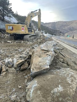
The benefit of this data-centric digital twin workflow in this context was that the team was able to work together to reduce rock cuts, bridge lengths, and impacts to the creek and canyon.
Leveraging digital tools made it possible to mitigate impacts to the surrounding natural environment, built environment, residents and other stakeholders while also providing a more efficient and cost-effective design.
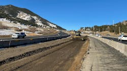
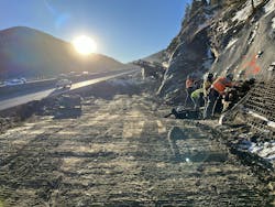
The Floyd Hill project construction began in earnest in summer 2023, beginning with east section. Construction on the west section is scheduled to start this spring, and the contractor expects to begin construction on the central section, which includes the new viaduct, later this year.
Project completion is expected in 2028. RB
Brad Dennard, P.E., is the senior vice-president and DOT business unit director for U.S., global market lead for roads at AtkinsRéalis.


