Brain in a cloud
A March meeting of transportation officials and transportation-industry members in Crystal City, Va., began to lay the groundwork for a new movement in digital asset data collection.
This effort is designed at systematizing the process of network asset data collection and 3-D virtual design while possibly laying the foundation for a highway base map to assist in ushering in the first generation of autonomous vehicle technologies.
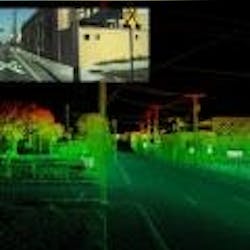
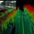
Imagine a 360º “cloud” traveling at highway speeds, digitally capturing and recording everything in its path—including road geometry, pavement cracking, signage, levels of retroreflectivity, location of guardrails, roadway markings, rumble strips and virtually any other safety device that is present on the roadway.
When finished, a high-resolution 3-D roadway profile is delivered to the state or local transportation agency where the data can be used to make better decisions in implementing more cost-effective and lifesaving roadway-safety improvements.
No need to imagine any further.
This futuristic, cutting-edge data collection technology exists today and is already providing roadway engineers with detailed inventories that give them a precise, clear picture of all of the assets that they are responsible for.
Nearly 100 of these like-minded data collectors recently gathered for the first annual meeting of the Geospatial Transportation Mapping Association (GTMA). Discussions focused on ways to improve agency decision-makers’ ability to create a safer, environmentally sound and efficient transportation infrastructure through the use of sophisticated mapping and data-collection technologies.
“GTMA members use a myriad of these technologies to collect pavement, bridge, pavement-marking and hardware asset data,” said GTMA President and CEO Robert Dingess. “This creates greater efficiencies in asset management, improvements in road safety and transparency in government.”
It seems the days of manually counting signs in one’s jurisdiction, visually measuring miles of guardrail or measuring the width of an edge line with a tape measure are soon to be over, replaced with something called lidar—or light detection and ranging.
Vehicles armed with lasers, cameras, software and sensors are traveling roadways today while their optical-sensing technology is simultaneously measuring the distance and specific properties of targets on the roadway. It does this by illuminating the objects with laser lights. The driver never has to get out of the vehicle, as data collection occurs automatically while traveling at regular speeds. The deliverable is a detailed and accurate inventory of everything on the roadway.
1.4 million points a second
Such data collection and inventory is well under way in Utah, where that state’s department of transportation—UDOT—contracted for the deployment of a mobile data-collection system that integrates lidar, photogrammetry, GPS, a 3-D pavement-imaging system and even some sign retroreflectivity technologies for a groundbreaking project that will set the stage for vastly improved asset management statewide. Utah’s data sets will be used to improve and develop rigorous safety, planning, maintenance and preservation programs. By confidently knowing the full details of UDOT’s multibillion-dollar infrastructure, the agency can make better decisions and ultimately save millions of dollars in maintenance costs.
UDOT chose the sophisticated system integration platform developed by Mandli Communications to gather no less than a dozen different roadway assets as their vehicles travel at posted speed limits. Assets include roadway distress data, surface areas, lane-miles, number of signs, right-of-way images, vertical clearances and more. Each of those categories is broken down even further into subcategories ranging from condition data to GPS data.
“Our system collects up to 1.4 million points of data per second to create a three-dimensional model of the environment,” said Mandli’s Vice President of Business Development John Caya. “The vehicle is capable of collecting this robust dataset in a single pass, including lidar, imaging, positional and pavement data.”
It seems the days of manually counting signs in one’s jurisdiction, visually measuring miles of guardrail or measuring the width of an edge line with a tape measure are soon to be over, replaced with something called lidar—or light detection and ranging.
On the marking
While the focus of the conference was asset collection, ways to improve maintenance operations also were on display. One example was provided by LimnTech Scientifics’ vision system that combines GPS and sophisticated software to locate and record existing roadway pavement markings at posted speeds with precision and accuracy.
Mounted to any vehicle, this innovative roadway safety invention is completely automatic and virtually assigns the proper location for the installation of roadway markings.
“It removes the road worker from harm’s way,” said Doug Dolinar, co-inventor of the system. “It finds the center of the roadway with precision accuracy. It also inspects and repairs existing pavement markings for contrast and presence without ever having to step onto the pavement. The system will save DOTs thousands of dollars.”
Another use of the technology Limntech discovered was a benefit for snowplow operators.
“Recorded pavement markings give the snowplow operator a virtual image of where the pavement markings are—in an inch or in a foot of snow—keeping the driver safely on course in any condition,” said Dolinar.
The benefits of these new technologies seem endless.
“Local agencies have smaller budgets and smaller staffs, but still have just as many roadway safety-improvement decisions to make every day. Collecting accurate data will help state and local officials pinpoint what needs a fix right now and what can wait until later,” said Dingess.
The GTMA membership includes private-sector data collection system integrators, consumers, hardware and software companies and the research and the public-sector officials that work with and utilize the data. ST


