By: Brian W. Budzynski
On a rough stretch of what is “commonly” known as the I-94 Commons—for the fact that at this particular location I-94 threads in with I-35, both interstates sharing a common series of lanes—a project has been ongoing since 2002 to gather traffic movement data in an effort to, ultimately, create safer ways for vehicles to travel.
“The connected vehicle technology is there, of course. It is present in certain car models,” John Hourdos, Ph.D., research associate professor in the Department of Civil, Environmental and Geo-Engineering at the University of Minnesota and director of the Minnesota Traffic Observatory (MTO), told Roads & Bridges. “But we’re talking closed systems or systems that are not valuable for real connectivity, such as infotainment systems.”
Nonetheless, the MTO has been actively engaged in running a test bed for connected vehicle technology on the I-94 Commons—a corridor that was chosen “because it is the highest crash zone in the state of Minnesota. There have been times when there are literally crashes every other day.”
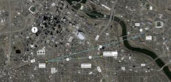
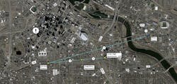
The testing corridor features comprehensive camera and radar coverage, tracking vehicle speed, placement and path of travel. Every moving object on all lanes is being tracked and generating data, which researchers are hoping will yield a significant amount of further research in the future. The top map photo here shows the main communication trunk line, while the bottom features aerial camera coverage (in green) atop which is superimposed the recently installed radar station coverage (red).
Building up
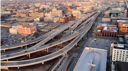
The Field Lab is located along a 2/3-mile segment of the I-94/I-35W Commons, running right through downtown Minneapolis. With the support of the Roadway Safety Institute and the Minnesota Department of Transportation (MnDOT), the MTO has been capitalizing on traffic monitoring and recording technology that has been in place for more than a decade.
“This CV test bed is an extension of a previous research laboratory, the equipment for which is still in place on the rooftops of buildings, dating back to 2002,” Hourdos said. “We have complete coverage from Riverside Avenue to the merge of I-35W NB to I-94 WB (3rd Avenue). All that remains. We also had machine vision sensors that were collecting individual vehicle measurements; these also remain.”
What the CV Field Lab adds is within MnDOT’s right-of-way, on the level of the road itself. There, a number of stations with smart microsystems (SMS) radar operate at 24 GHz. This radar-based vehicle detection and traffic measurement collection network has been established, melding the recording of high-resolution radar data with high-resolution cameras in order to capture the position and speed of any vehicle moving on any lane in the test zone, at 20 times per second.
“We are using three different types of SMS for coverage across the lanes,” Hourdos went on. “Each covers about 80-300 meters. We’re using them as road sensors that return at 20 Hz the position and speed of anything that moves on the road. They are deployed with overlapping areas to minimize blind spots. So from Chicago Avenue to 3rd Avenue, we have a complete trajectory of vehicles as they travel this distance. On top of the radar, for monitoring, we have installed cameras. So, we have video and data for this part of the road.
“It’s not perfect, of course,” Hourdos conceded. “But the primary goal for this has been to create basic safety messages for connected vehicles to transmit. Because the reality right now is that not even 0.1% of vehicles on the road are connected. The technology exists but it’s not really out there. If we want to do serious research on CVs, we need to have CVs, so the primary goal is to capture the location and attitude of vehicles in an area in a good enough resolution to help create basic safety messages, such as GPS location, acceleration, speed and so forth.”
Getting creative
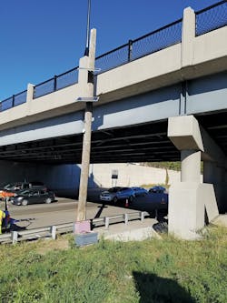
Right-of-way restrictions and restrictions imposed by MnDOT resulting from the fact that I-94 is presently under reconstruction forced the research group to get creative in order to power the new on-road stations along the corridor. Consequently, the group has produced its own solar stations in order to power the instrumentation they needed to place within the agency’s ROW. Temporary poles have been installed with solar panels. At the foot of each pole is a battery box, and there are radar and cameras and radio likewise installed to communicate with the rest of the system.
“It is a completely self-sufficient system,” Hourdos said. “The bottom line is seamless camera coverage with high-resolution radar. How we did it is a bit of a mix depending on whether in a given spot we did or did not have power and communications. And with the road alignment changing, we’re having to move our instrumentation eastward. The equipment cannot be where the construction is, of course; we’re expanding our coverage of the area.”
The new limits of the test corridor do not compromise the scope of the data collection, but merely shift it to the east. Park Avenue, which is presently the eastmost limit of the test zone, will now become the westmost limit, and Cedar Avenue will become the eastern limit.
MnDOT restrictions forced the research group to produce its own solar-powered stations, such as the one pictured here, in order to power the instrumentation they needed to place within the agency’s right-of-way. Poles were installed with solar panels; at bottom is a battery box, and there are radar, cameras and radio to communicate with the rest of the system, making for a completely self-sufficient tracking station.
Results pouring in
Since the project team’s goal is to be able to recreate basic safety messages (BSM) for broadcast through the vehicles’ on-board units, the possibilities for research based on their data accumulation are significant.
“We have two years worth of trajectory data,” Hourdos said, “which includes coverage of at least 70 accidents that have happened in this area. What’s funded right now is a queue-warning system. This area has particular problems with rear-end collisions and shockwaves. Now we’re trying to develop a system based on BSM and infrastructure sensors. Melding these two methods will be much more precise. There also is a new MnDOT funded project using the data we’ve collected on this corridor, which is to investigate the development of traffic performance measures on collected BSMs from vehicles. It’s basically using data we’ve collected from the test bed and from it calculating traffic measurements to see if DOTs can eliminate point sensors for measurements they need to monitor traffic conditions, and to go strictly with traffic data provided by connected vehicles. This has just gotten underway. I’m encouraged by these developments.”
Hourdos is hopeful that among the immediate safety benefits of the group’s work will be that there will be far fewer collisions due to driver distraction and an increased awareness of vehicular surroundings. “You cannot eliminate collisions because someone was drunk, but anything that has to do with the driver not paying full attention will be improved.”
All that is left, it seems, in order for work such as that being done by the MTO to see practical application, is for policy makers to settle on the question of dedicated short-range communications (DSRC) or the 5G cellular network for handling the overarching CV communications environment.
“We have two huge lobbies fighting for dominance,” Hourdos indicated. “They work on the same spectrum, but they do not talk to each other. Someone has to win. We have CV technology right now; it’s not a science problem anymore; it’s a regulatory policy problem now. Right now we need to decide what the communication method is going to be.”
Hourdos sees pros and cons.
“DSRC is technologically sound, sure, but it is not economically viable. It requires state, city, and county jurisdictions to deploy mass amounts of equipment. Right now most don’t have the funds to replace signal controllers that were installed in the 1980s, never mind having the dollars to put roadside units (RSUs) every 2,000 ft along the roadway they are responsible for. There is no way. Who’s going to pay for that? With 5G cellular, however, the spectrum is already there. It’s readliy available. The towers are there, the system is there. There is no infrastructure question. But the question is, do we give this over to the private sector? Would it act as it should? Would it be magnanimous? Or should the government retain control? Either way, the government needs to legislate. Once it’s decided, this technology will happen very, very quickly.”
About The Author: Budzynski is managing editor of Roads & Bridges.
