By Vicki Speed, Contributing Author
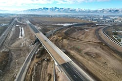
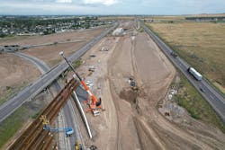
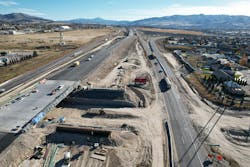
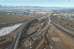
Eight bridges, over one million cubic yards of excavated earthwork, 12 mechanically stabilized walls of about 70,000 square feet, new roadways, and multiple ramps—all in a compact work zone under alongside interstate traffic.
That’s a snapshot of the Idaho Transportation Department’s (ITD) massive Interstate-86/Interstate-15 System Interchange project in the Pocatello and Chubbuck metropolitan area.
Known as the “Flying Y,” this interchange was built in the 1960s. It was designed with short left-sided merges and ramp curves, which have created congestion and a higher rate of accidents as the area has grown.
The new interchange project includes roadway, ramp and bridge upgrades, as well as the addition of a pedestrian and bicycle path. According to ITD, the project will improve safety, mobility, and economic opportunity by upgrading the roadway and bridges to current engineering standards while also dramatically improving turning movements for motorists.
In spring 2022, ITD selected the joint venture team of Sundt Construction and Cannon Builders to facilitate the reconstruction of the interchange. The project required cohesiveness to ensure the safety of motorists and field crews.
The three-year I-86/I-15 System Interchange construction incorporates multiple pieces:
- The ramp connecting I-15 northbound to I-86 westbound will be reconfigured to exit from the right-hand side of the northbound I-15 lanes, rather than from its present location on the left-hand side.
- Between the Pocatello Creek and Northgate interchanges, I-15 northbound lanes will be constructed west of their present location in what is currently the highway median.
- The ramp connecting I-86 eastbound to I-15 northbound will be reconfigured to merge on the right-hand side of the northbound I-15 lanes, rather than the current left-hand entrance.
- Chubbuck Road will be lowered and rebuilt as an underpass to I-15, which means oversized vehicles will no longer have to detour off the interstate. Two new bridges will be constructed for I-15 over Chubbuck Road. Additionally, parts of the existing I-15 northbound will become new collector-distributor lanes to relieve congestion as drivers travel north toward Chubbuck from the Pocatello Creek on-ramp.
Maintaining traffic flow through the narrow work zone has been a challenge. Ensuring the safety of construction crews who are working near motorists has been the project’s top priority.
“Our crews are essentially sandwiched between high traffic areas everywhere we work on this job,” said Thiago Bezerra, Sundt project manager.
Bezerra recalled several incidents over the last two years where motorists accidentally left the highway and entered the work zone.
One car passed within 20 feet of work crews.
Weather is also a factor in this part of the country. Since crews continue to work through the winter, there’s an increased likelihood of cars losing control on wet or icy roads.
“Technology is proving to be an essential piece of this project to keep our crews safe while maintaining productivity,” Bezerra said.
For Sundt and Cannon Builders, the I-86/I-15 System Interchange is a relatively straightforward road and bridge construction effort—the real challenge is coordination and logistics.
“The project is essentially a giant, highly coordinated puzzle,” said Bezerra. “We must continually shift resources—both material and equipment. On any given day, we might excavate soil in one area to build a new highway segment. However, some of that soil is underneath live traffic, so we have to transport soil from a different area to complete a task.”
According to Bezerra, keeping everyone safe and productive is where technology, particularly a global navigation satellite system (GNSS), provides an essential value.
Currently, two rovers and a base station are set up on the job to ensure a continuous signal and accurate positions anywhere on the project site to support survey instruments and equipment.
Using 3D baseline design models provided by ITD as a foundation, Sundt and Cannon Builders were able to clean the models to support earthwork activities across the job site. The models were further refined to support the different layers, including subgrade, base, and asphalt.
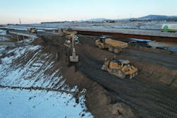
Aerial survey data collected was also layered into the earthwork models. Each day, the models are sent to the GNSS-equipped construction equipment, which includes multiple motor graders, excavators, and dozers.
On the interchange project, many work areas are right up next to the highway. Equipment operators reference the pre-loaded digital designs to safely guide grading and other work from within their cabs.
Surveyors use rovers to spot check work, minimizing their exposure near active equipment and traffic.
“GNSS equipment helps us avoid having surveyors continually working on the ground next to this traffic,” said Michael Marsh, project engineer with Sundt. “The pre-loaded models greatly reduce the time our surveyors have to spend on the ground staking or checking. We can do this because we are confident in the model and in our GNSS-equipped machines.”
All heavy equipment has blind spots, and with every worker focused on their own tasks, there is still the potential for accidents. The integrated GNSS systems help by allowing data sharing between equipment in real-time, improving communication and workflows while eliminating the need for people on the ground.
“With GNSS on our machines, we can send a blade out to check the grade rather than sending a person on the ground,” Marsh said. “We’re trying to eliminate the need for people on the ground in the midst of all of this big equipment and interstate traffic.”
That scenario plays out daily on the jobsite. Bezerra noted that in one case, an excavator operator was working in tight conditions with limited visibility and considerable heavy equipment traffic around a relatively small area, right next to live traffic.
Rather than have a surveyor on foot to support the operator, a nearby bulldozer equipped with GNSS technology was used to safely guide the excavator.
The dozer operator could reference the digital design model from within the protected cab to check elevations and guide the excavator's work, without needing a person on the ground and in harm’s way.
Bezerra and Marsh said they believe that the I-85/I-15 is a flagship project for ITD because of its scope and scale and in its project delivery means and methods.
Perhaps most impressive is the symmetry between Sundt and Cannon Builders. Crews from both companies are using shared tools, software, and equipment across the project, with no distinction between the two companies.
GNSS and other technologies are a big part of delivering that cohesive environment, helping the contractor teams to streamline communication and data sharing.
“We’re seeing real demonstrated safety and efficiency improvements," said Marsh. “All of the different layers of linework are already in the software on our equipment. Now we can have, for instance, seven operators on seven pieces of equipment instead of five operators and two on-the-ground surveyors.
“We’ve eliminated concerns about blind spots, and we’re not exposing our surveyors to weather, steep slopes or other equipment.”
Sundt has even deployed a GNSS solution on a skid steer to support work on the interchange project.
The I-86/I-15 System Interchange project is a little over 50% complete and on track to finish on time and on schedule in mid-2025. RB
Vicki Speed is a freelance writer covering the construction industry.
