By: Andrew Sullivan, P.E., PTOE
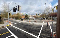
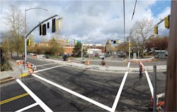
28th and Hoyt.
The neighborhood greenway system in Portland, Ore., forms the backbone of the city’s renowned bicycle network. The idea is simple: Select a quiet residential street parallel to a bustling arterial and enhance it to create a pleasant yet efficient cycling environment that appeals to a broad spectrum of potential users. Neighborhood greenway streets are designed to prioritize bicycle mobility while preserving a low-stress riding environment. Today, neighborhood greenways make up over 70 miles of Portland’s bicycle network. These facilities have been crucial to the growth of cycling in Portland, which now boasts a citywide bicycle mode-split greater than 7%.
With an ambitious cycling mode-split goal of 25% by 2035 and a limited budget, the Portland Bureau of Transportation (PBOT) initially elected to allocate its funding for bicycle improvements on “low-hanging fruit” projects, which were inexpensive and easy to construct quickly. Given the bias of Portland’s overall roadway network towards well-connected east-west streets, much of today’s existing neighborhood greenway network runs east-west. In recent years, attention has shifted toward construction of the more difficult north-south routes. The 9-mile-long 20s Bikeway is the first such project to traverse the entire length of Portland from north to south. Encompassing 13 inner northeast and southeast Portland neighborhoods, the route runs through the heart of Portland’s cycling culture. Many of the census tracts in this region of the city already have bicycle mode-splits that approach that lofty 25% citywide goal. While the current numbers are impressive, the proximity of these neighborhoods to major employment centers and recreational opportunities means these areas have the potential to foster extraordinary cycling metrics. Therefore, PBOT’s primary objective for the 20s Bikeway project was to construct a facility that would generate additional interest in cycling and cultivate new ridership among the residents of these neighborhoods.
Getting it right
Selecting an appropriate design rider is critical to guiding the design process of any bicycle facility. Unlike motorists or pedestrians who are expected to possess a similar set of skills and abilities, cyclists collectively possess a broad range of skill levels, abilities and tolerances for stressful riding environments. At PBOT, this spectrum of riders is separated into four categories (estimated proportion of Portland’s population in parentheses):
- Strong & Fearless (< 1%)—This person will ride on any street regardless of conditions;
- Enthused & Confident (7%)—This person will tolerate brief exposure to high-stress conditions but values low-stress environments;
- Interested But Concerned (60%)—This person may ride occasionally for recreational purposes and is interested in riding more regularly, but currently lacks the confidence to coexist with motor-vehicle traffic; and
- No Way, No How (33%)—This person has no interest in riding.
With the goal of generating new ridership, the 20s Bikeway was designed to appeal to an Interested But Concerned rider. To meet the needs of this design rider, the creation of a seamless, low-stress cycling environment throughout the entire corridor is paramount. Colloquially, this is referred to as an “8-to-80” facility, a bikeway that is comfortable to use for anyone as young as eight years of age or as old as 80 years of age.
Funded by a $2.4 million federal grant and provided with the guidance of a line on the Transportation System Plan map, the project kicked off development and public process in 2013. The final design was hinged upon a recommended route endorsed by the project Stakeholder Advisory Committee, a collection of neighborhood representatives, local business owners and bicycle advocacy group representatives. Early on, the challenges of the planned route became agonizingly apparent. Several critical components of the route were projected along narrow arterial roadways to take advantage of existing signalized intersections to cross perpendicular arterials. In several locations, the proposed bicycle facilities were in direct conflict with previously established roadway uses. These segments became the focal points of a contentious public process that lasted more than a year before a recommended alternative was endorsed by the project Stakeholder Advisory Committee.
28th and Powell
The route taken
Previously constructed to accommodate a historic streetcar line, 28th Avenue between NE Sandy Blvd. and SE Stark Street was the crux of the entire project development stage. Just two-thirds of a mile in length, the most controversial segment of the planned route comprised less than one-twelfth of the overall project length. Characteristic of historic streetcar streets in Portland, this arterial roadway features a curb-to-curb width of 36 ft. The street has enough room for a 10-ft travel lane in each direction with parking along both curbs, and it serves roughly 7,000 vehicles per day. A thriving storefront commercial district flanks both sides of the corridor. Just north of the commercial strip, 28th Avenue provides a scarce crossing of I-84. Despite lacking bicycle facilities of any kind, 28th Avenue is very popular among cyclists for its direct access to destinations along the corridor and as a link across the freeway.
There is only one way to get adequate bi-directional bicycle facilities on a 36-ft-wide two-way street without compromising its basic functions for vehicles and pedestrians. The trade-off is wholesale parking removal. This subject was deeply polarizing among community members. Those in favor viewed the loss of parking as a worthy sacrifice to enhance and solidify 28th Avenue as a vital component of the city’s bicycle network. Many opposed viewed parking on 28th Avenue as an essential element to the continued success of the adjacent business district. Others were worried such a large loss of on-street parking capacity would lead to a decrease in neighborhood livability, with additional motorists filtering onto adjacent streets in search of parking. Compounding matters for parking-removal proponents, the project team also was developing a neighborhood greenway facility on adjacent side streets to serve cyclists that would not be comfortable cycling along with heavier traffic. This prompted opponents of parking removal to raise a valid question. If the adjacent facility was adequate for riders of all ages, then why pay the steep societal cost of wholesale parking removal? Ultimately, the Stakeholder Advisory Committee sided with this sentiment and endorsed a recommended alternative that utilized adjacent side streets as the primary route.
Due to limitations of the surrounding roadway network, the alternative alignment practically chose itself. As the only continuous street linking the northern and southern extensions of the route, a neighborhood greenway facility on NE/SE 30th Avenue turned out to be the best alternative. This alignment required crossing a pair of arterials at offset intersections, but before those locations could be addressed, the design team needed to develop a comfortable transition between the freeway overcrossing and the neighborhood greenway two blocks east. This was particularly challenging when considering the southbound cyclist, who needed to cross NE 28th Avenue to complete the connection. The first available street connecting east (NE Oregon Street) proved to be problematic. Situated less than 200 ft south of a major signalized intersection, the crossing is frequently blocked by queued motor vehicles. Additionally, its geometry as a T-intersection afforded minimal space for bikes to comfortably stage for a crossing.
Another crossing location needed to be identified.
30th and Stark
A minor felicity
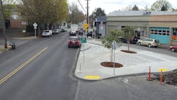
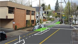
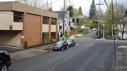
As if by fate, an anomaly in the roadway network provided an area of opportunity just two blocks south. For a short distance, the neighborhood cell to the west features a street grid that is rotated approximately 30° relative to the rest of the surrounding street grid. At one intersection, these skewed grids converge in an unusual, yet fortuitous, geometry. To reach it, the price was two blocks of valuable parking along the west side of 28th Avenue to create space for a southbound bicycle facility. Acknowledging the importance of this connection, support for this design was unanimous among stakeholders.
Prior to construction, a diminutive concrete island was all that occupied an expansive triangular swath of asphalt where NE Randall Avenue and NE Buxton Street converged on the west side of NE 28th Avenue. Not only was this right-of-way underutilized, it also represented a significant weakness in pedestrian connectivity. Repurposing this area, the bike crossing treatment now installed doubles as a significant upgrade for pedestrian mobility. Although the route officially shifts away from NE 28th Avenue south of this point, the cycling environment is better than it was before the project. The posted speed limit is now 20 mph and the roadway features “fire-friendly” speed bumps—a four-pillowed speed-bump design permitting unabated emergency-vehicle passage—to keep travel speeds low within the corridor.
With the transition to the freeway overpass established, attention turned to the offset crossings at
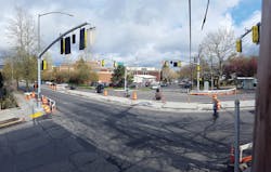
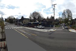
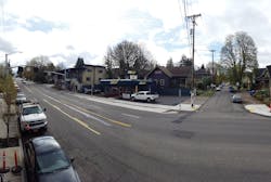
E Burnside and SE Stark Streets. Although the Burnside location at first seemed more daunting with its higher traffic volumes, wider cross-section and larger offset, the solution was relatively straightforward. The available parking lane was reclaimed and combined with the mostly unencumbered pedestrian corridor to create a grade-separated two-way cycle track linking the crossing improvement—a pedestrian hybrid beacon—at NE 30th Avenue with the southern extension of the route on SE 30th Avenue. The narrower and less busy SE Stark Street crossing proved to be the bigger challenge.
Possessing favorable topography, the route approaches SE Stark Street from the south on SE 29th Avenue. Logically, SE 29th Avenue was initially examined for the Stark crossing. However, this concept was quickly discarded for familiar reasons. Positioned just 200 ft east of an existing signalized intersection, motor vehicle queues routinely blocked that intersection. As another 36-ft-wide street, SE Stark Street is too narrow to install a mitigating refuge island without impacting turning movements from the side street. Instead, the route shifted east to SE 30th Avenue via SE Washington Street.
Optimistically speaking, the shift to SE 30th Avenue needed to take place at some point so the lateral shift was not a detriment to the overall user experience. However, from a design standpoint, the earlier shift added considerable complexity. SE 30th Avenue is classified as an arterial roadway south of SE Stark Street (the classification jogs east from SE 28th Avenue at SE Stark Street). Despite its classification, SE 30th Avenue was stop-controlled at SE Stark Street at the time of design. Naturally, given the offset in the north-south arterial classification, a considerable northbound left-turn demand exists at this intersection. With the northern leg of SE 30th Avenue aligned ever so slightly to the west of the south leg, the bikeway crossing was in direct conflict with the major northbound traffic movement. It became immediately clear that controlling all movements with full signalization was a must to establish a safe and comfortable crossing.
To keep northbound cyclists from interacting with traffic on SE 30th Avenue unnecessarily, a two-way cycle track was implemented along the west side of SE 30th Avenue. This provides a seamless link between the greenway on SE Washington Street and the new signalized crossing at SE Stark Street. The slight offset between the two approaches of SE 30th Avenue turned out to be advantageous. The two-way cycle track continues straight across the intersection while simultaneously acting as a motor-vehicle diverter, blocking auto ingress from the south. Southbound auto egress is restricted to right turn-outs, away from the main bicycle movement. The signal operates with three phases: permissive east-west movements, exclusive northbound auto movements and north-south bike/pedestrian movements with permissive southbound right turns for autos.
Further south, the planned route was identified on SE 26th Avenue to take advantage of an existing signal to cross SE Powell Blvd., also known as U.S. 26. SE Powell Blvd. is among the busiest non-freeway roadways in the entire region, carrying traffic volumes exceeding 40,000 vehicles per day. As a designated U.S. highway, it is under the jurisdiction of the Oregon Department of Transportation (ODOT). Much like the controversial segment further north, SE 26th Avenue is another 36-ft-wide arterial roadway. Among the earliest of Portland’s roadways to be retrofitted with bike lanes, parking had been removed from the west side of the roadway to stripe a pair of 10-ft motor-vehicle lanes and 4.5-ft bike lanes. A 7-ft parking lane remained along the eastern curb. Approaching SE Powell Blvd., the parking lane is dropped and the bike lanes are narrowed by a foot to accommodate a 9-ft left-turn pocket in each direction. In such a constrained environment, modifying this intersection to meet the needs of an 8-to-80 rider was not feasible, given the project scope and budget.
Once again, a viable alternative route had to be identified.
30th and Burnside
A ready alternative
Fortunately, the design team didn’t have to look far for the answer. Approximately 500 ft east lies SE 28th Avenue. While slightly hillier than the planned route, SE 28th Avenue was cemented as part of the project alignment further to the south. By maintaining the route on SE 28th Avenue, the 1.8-mile segment between SE Woodstock Blvd. and SE Clinton Street became the longest stretch of the entire 20s Bikeway without a lateral jog to a parallel street. Although SE 28th Avenue was the logical choice to cross SE Powell Blvd., getting a crossing to work at that location was a tall order. A full signal was necessary. ODOT was initially very concerned that a new signal would be detrimental to the operation of this congested roadway. To its credit, ODOT recognized the inhospitable cycling environment that existed at SE 26th Avenue and continued working with PBOT to come up with an effective solution. Despite differing philosophies regarding roadway design and operations, the two agencies collaborated on a solution that was agreeable for both sides.
Coincidentally, ODOT had just initiated a road-safety audit for a segment of SE Powell Blvd., and PBOT’s desired 20s Bikeway crossing at SE 28th Avenue was within the bounds. Conveniently, an upgrade of an existing pedestrian crossing at SE 28th Place, a discontinuous street one block east of the SE 28th Avenue, was among the recommendations of the audit. PBOT negotiated an agreement with ODOT to fund the relocation of the existing crossing in exchange for the right to construct the new traffic signal. The new signalized crossing features a diverter island that is permeable to cyclists and pedestrians, but limits auto access to right-in, right-out movements to prevent the attraction of additional motor-vehicle trips to the greenway. Appropriately, the crossing improvement at SE Powell Blvd. was the final component of the 20s Bikeway to be confirmed; a literal and symbolic keystone of the entire project.
Initially scoped without any new traffic signals, the 20s Bikeway project ultimately installed five new signalized intersections and added significant civil improvements at over a dozen other intersections. It comes as no surprise that the awarded bid of $4.6 million nearly doubled the original budget. The funding gap was backfilled by transportation-system development charges, which allowed the project to be constructed in its entirety. Despite a significantly expanded scope, city leadership deemed the extra expense a worthy investment into Portland’s transportation future.
As summer approaches, it’s time to ride in Portland.
---------------
Sullivan is senior engineering associate for the City of Portland Bureau of Transportation’s Traffic Design Section.
