Strengthening an urban connection
By: Erik Fanselau, P.E., CFM, LEED AP, and David Lindahl
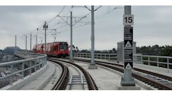
The recently completed R Line extension has brought light-rail service to the heart of Aurora, Colo., a suburb of Denver. Located along the I-225 corridor, the R Line extension is 10.5 miles long and was completed at a cost of $687 million. It traverses an urban environment, and includes eight new light-rail transit (LRT) stations and seven bridges with three water crossings. The project also included roadway improvements, drainage infrastructure and utility relocations.
What it is
The R Line is an important component of the Regional Transportation District (RTD) FasTracks program. FasTracks is a multibillion-dollar public transportation expansion plan in metropolitan Denver. Developed by the RTD, the plan focuses on the development of six new electric commuter rail, light-rail and express bus services over the combined length of 122 miles. It expands on previous transportation projects and includes 57 new transit stations and stops, 21,000 new parking spaces, 18 miles of bus rapid transit service between Denver and Boulder, and the renovation of Denver Union Station as a multimodal transportation hub. The R Line extension connects the existing RTD system from Peoria to Nine Mile station. The R Line continues past Nine Mile to the south running on existing light-rail infrastructure to Long Tree’s Lincoln Station.
AECOM partnered with Kiewit Infrastructure on the R Line design-build project for the RTD. A nationwide team of experts was brought in to work on the project, with team members drawn from 13 different offices, 18 subconsultant offices and 200 designers. Interestingly, the use of cloud-based project software significantly reduced travel time, because real-time collaboration was able to occur online rather than face to face. Teams were able to work collaboratively across offices without the need for staff to relocate to Denver, which enabled the use of resources most efficiently. File sharing also was streamlined, thus preventing unnecessary rework and schedule delays.
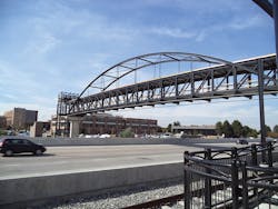
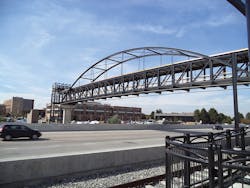
A pedestrian bridge offers station access over I-225.
Project need
The objective of the R Line development was to extend RTD’s light-rail transit system within the I-225 corridor and provide connections on each end to the existing RTD LRT and commuter-rail system. The project helps address several transportation-related needs in the project study area as identified through previous planning efforts, public scoping, agency involvement, community outreach and project-partner participation.
It was determined that a fixed-guideway transit improvement in the I-225 area would meet a number of specific needs, such as:
- Improvements to provide a reliable multimodal system;
- Improvements to regional connectivity;
- Meeting a voter mandate to be cost-effective and financed as part of the FasTracks program budget;
- Reflecting community and regional plans and programs; and
- Attracting new transit riders while serving traditional transit users.
The system design was complex due to the interface between train and street traffic. Building a complete LRT system within an urban environment was a major challenge, necessitating right-of-way impacts and the relocation of utilities. Due to the complexity of the project, a wide range of alternatives were evaluated for station platform locations, park-n-ride locations and light-rail alignments. The alternatives were assessed in a multi-step screening process that built on previous planning efforts and took into account such issues as operations, engineering criteria, environmental considerations and community acceptance. The process produced a preferred alternative that had broad public and agency support.
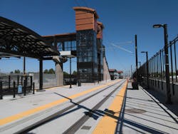
The R Line connects and expands the existing RTD system.
Impacting the community
The construction plan that was chosen required that a number of environmental issues be addressed because of the impacts they could have on the community. In each instance designers implemented a plan that would resolve potential problems or provide aesthetic enhancements.
Right-of-way and relocations: Throughout the planning process, efforts were made to minimize the degree of right-of-way required for construction affecting rail alignment and station locations. Meetings were held regularly with impacted business owners. Acquisition and relocation assistance was provided for all affected residents and businesses.
Social impacts: A benefits and burdens analysis determined that access to LRT would offer significant benefits to the general community by providing enhanced access within the city and surrounding areas.
Floodplains/wetlands: Encroachment on floodplains located along nearby creeks was subject to federal, state and local oversight. Specific engineering design and mitigation was implemented to ensure that the requirements were met and future flooding or other adverse impacts would not occur during the operation of the LRT. During the course of the project, wetlands and waters were located, identified and evaluated throughout the I-225 corridor. Measures were then employed to avoid or minimize impacts. Those impacts that could not be avoided or minimized were mitigated. AECOM provided a hydraulic analysis for all three river crossings to ensure the bridge and channel construction would not adversely impact conveyance capacity or negatively impact the floodplain.
Visual and aesthetic resources: The presence of the LRT throughout Aurora has introduced new visual elements within the city, the most noticeable being the changing traffic pattern, the new LRT stations, park-n-ride facilities and the LRT track running along arterial roads. The city’s public art commission also spent years of planning and millions of dollars to commission a variety of art pieces. A glass bridge over I-225, plastered with rainbow-colored speckles, resonates sounds of animals and jazz music from the rafters above. Art will be installed at all eight R-Line light-rail stations. Travelers on the line can see and experience nine separate sculptures, decorative wind screens and community murals, providing local artists with an additional arena for displaying their work. For example, the “Bike Train,” which will be installed at the 13th Avenue Station, is a spinning, swirling sculpture with 40 used bikes, donated by local residents, welded to it. “Sunrise,” a 16-ft-diam. interactive solar disk features 24 turning wheels elevated 2 ft above the Aurora Metro Center station. Each piece of art was selected and commissioned by the city of Aurora and RTD to characterize the individual stops and unique neighborhoods throughout the city.
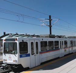
A train arrives at Peoria Station
Spurring economic development
The completion of the R Line has already had a positive impact on community development in Aurora and holds the promise of greater development opportunities in the near future. Early on in the planning process for the rail line, the city passed a comprehensive plan for transit-oriented development (TOD), a host of residential, commercial and open-space developments centered around many of the new light-rail stations. Benefits of TOD include connecting housing, office, retail and open-space/recreation areas with transit, and reducing the need for personal vehicle trips. This also includes smart development within a walkable neighborhood. Transit construction increases property values by providing additional commuting options to residents, employees and visitors.
Four stations are anticipated to stimulate significant development adjacent to the rail line: Metro Center, 2nd/Abilene, Iliff and 13th Avenue. All of these locations have some form of residential, retail or commercial development planned near the stations. At the 2nd/Abilene Station, more than 760 high-density residential units and 17,000 sq ft of retail space are planned adjacent to the station. This site also is within walking distance of the Aurora City Place shopping center. The Highline Canal Trail connects to the site, which provides more than 70 miles of recreational access to hikers and cyclists.
The largest proposed development along the R Line is located adjacent to the Metro Center Station. This 772-acre planning area includes the Aurora Municipal Center (City Hall), Town Center at Aurora, an RTD regional bus transfer facility, Aurora City Place shopping center and the Arapahoe County Administrative Offices, in addition to vacant parcels located adjacent to the R Line. The development plan includes a mixed-use urban-core hub with shops, restaurants and 450 residential units adjacent to the Metro Center Station on approximately 80 acres of vacant land. It is expected that this development will help create a new downtown identity for the city of Aurora for both residents and visitors. The development also will include improved access for pedestrians and bicyclists. The R Line construction is a key feature of the success of this urban renaissance.
Since its opening in February, the R Line extension has been a success for the region and its people. RTD estimates ridership figures will be at 12,000 per weekday after the first year of operation. The project has stimulated economic development and reduced traffic in the region, while providing new transit connections to Aurora’s Metro Center station. And not least importantly, the new LRT line provides the only connection to the Anschutz Fitzsimmons Medical Campus, presently home to the University of Colorado hospital, medical school and children’s hospital, which is expected to have 45,000 visitors annually at full development—a process that will include a new Veterans Administration hospital.
------------
Fanselau is deputy project manager for AECOM, Denver, Colo. Lindahl is CAD manager for AECOM, Denver, Colo.
