By Rory San Miguel, Contributing Author
Carlos’ Law is primed to go into effect in New York. The law aims to make construction workplaces safer. It also would substantially raise the minimum fines for construction companies found liable for onsite injuries from $10,000 to $500,000, and in the case of a misdemeanor, no less than $300,000. Considering that one in five worker deaths in the last calendar year were in construction, this law is meant to set a national precedent for a stronger focus on worker safety.
To keep workers protected, operators are turning to new technologies to manage the many factors that go into safety on a construction site, such as wearable health monitoring tools and more advanced uniform materials. Another such technology is drone data visualization, which involves flying a drone over a site to capture a highly accurate 3D model of current conditions in near real-time.
With its host of benefits for construction sites, drone mapping technology is an additional option in a site manager’s toolbox as they seek to achieve the highest safety standards.
Remote surveys help keep workers safe
Arguably the most impactful worker benefit of drone surveying is removing construction workers from harm’s way.
In traditional survey methods, multiple workers have to venture into the field, traversing potentially unsafe terrain, such as dangerous mine blast areas, narrow haul roads, or unstable material piles to obtain measurements. Flying a drone enables surveyors to stay on stable ground while safely navigating dangerous terrains and slopes. Drone mapping also helps workers avoid constantly moving heavy machinery while they fly the drone above the site.
With drone surveying, crews are on the ground for less time than traditional survey methods, greatly reducing the risk for an injury to occur. With flight times as short as 10 minutes, depending on the area needed to be covered, drone surveying cuts down the time needed to obtain accurate models of a site. Mapping a site becomes as simple as programming a flight path and piloting the drone, and it yields just as accurate results.
Finally, 3D mapping with a drone may allow surveyors to stay in the shade while piloting, reducing the risk of excess heat exposure. While bright, sunny conditions may not represent ideal conditions for people as temperatures climb, drones fly and capture images best in hot, dry weather, making them literal lifesavers for surveyors working in hot climates.
Precise measurement to maintain safe site conditions
Drone data visualization allows site operators to measure quantities of earth and distances to within 1/10th of a foot, raising confidence for any safety check.
Highly accurate 3D maps generated from drone photogrammetry can measure key safety metrics such as bern heights, contouring, haul road grades, and other site conditions.
Take, for example, haul roads: Operators must inspect the road surface, drainage, grade, and erosion to ensure these roads can support the massive size and weight of on-site vehicles.
Using frequent surveying and a 3D site modeling platform, operators can visually inspect roads and track how they change over time. They can also colorize the grade of all the road surfaces and focus on problem spots where a road may be too steep to traverse. Finally, drone mapping also can identify hazardous cambers, alerting operators to road areas that need to be avoided or leveled off.
Marking hazards to protect the entire team
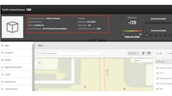
Since all drone data is imported into and kept within a single platform, construction site managers can more efficiently mark hazards and communicate them to their teams.
From a safety compliance standpoint, having an accurate 3D map of a construction site helps operators pass OSHA inspections more easily, allowing them to reference robust documentation of site conditions.
Frequent drone flights also give a surveyor the opportunity to spot hazards and detect irregularities, fissures, and potential slips before they become a problem. Meanwhile, creating survey maps from drone images helps create a paperless, precise visual record of site hazards, that allows any user to quickly pinpoint problem areas on site for the entire team to see.
Operators can also highlight zones larger than specific points or features, like the visitor parking lot, slow-speed zones, or open trenches, to designate where people should be careful. These areas can then be easily updated by adjusting the boundaries using the latest drone survey.
With the proper cloud-based platform, sharing safety information becomes as easy as sending an email or providing a link, and operators can use keyword searches to pull out specific safety-related measurements to create in-depth reports for all key stakeholders.
The next era of construction safety
Advanced tools like drone surveying will be crucial in not only protecting current construction workers, but also in assuring new workers that they are entering a field that has an uncompromising standard for safety.
3D mapping with drones allows operators to maintain safe site conditions through accurate monitoring, identifying potential dangers before they arise, and marking regions of concern.
With drone surveying technologies, construction site managers can ensure every person feels even safer onsite, so they can continue to do their best work. RB
Rory San Miguel is the Sydney-based CEO and co-founder of Propeller Aero, which provides cloud-based data visualization and analytics to worksites.


