By Leon Shneider, Contributing Author
No one wants to drive down icy roads with reduced visibility in winter. When one false move can result in disaster, accurate road weather information is vital.
By optimizing maintenance operations, organizations can reduce the number of hazardous situations drivers face. Road weather information —the measurement of atmospheric, pavement and or precipitation level conditions— helps maintenance crews clear and treat roads, minimizing accidents and traffic delays.
However, measuring road weather parameters in certain locations is challenging. From bridges to bike lanes, some areas are more demanding to monitor than others because of unique microclimates, physical barriers, or limited access.
Consequently, road operators struggle to obtain reliable road weather data, leaving gaps in their understanding of road conditions that can ultimately compromise safety and efficiency.
Advancements in Internet of Things-based systems (IoT) and sensors are bridging the gaps in these challenging locations, providing crucial information to enhance road safety in less time.
Generating Road Weather Information
Effective road maintenance decision making demands the most accurate road weather information possible. Whether informing salt and chemical material usage, maintenance task timing, or fleet deployment, road weather data must be precise and error free. Anything less risks wasting time and material and can endanger lives.
Created for road maintenance professionals, road weather data is calculated for either road segments or road weather station locations and assesses the road’s surface. Consequently, there can be significant differences between what's happening in the air and on the road surface, challenging authorities to adequately monitor road weather conditions along their network.
So, how is road weather information generated? It’s a complicated process that begins by looking at global atmospheric data and combines several other data sources to create a comprehensive model that forecasts road weather information.
Most road weather forecast models combine atmospheric data with physical road conditions, weather forecasts, and dozens of other factors to roughly calculate near-future road surface conditions.
Road weather information is collected using various technologies and techniques, including road weather information stations installed along roadways and remote sensing technologies.
Road Weather Information Systems (RWISs) collect data on a range of weather parameters, typically using thermometers, hygrometers, anemometers, and precipitation gauges. Remote sensors leverage different technologies to measure the distance and velocity of objects in relation to the vehicle, detect heat radiation, or sense other phenomena to gather road weather data.
Collecting data on temperature, precipitation, wind behavior, humidity, visibility, and road surface condition is critical for ensuring road safety and efficiency. Data collected from RWISs and remote sensors is typically transmitted to a central location for processing and analysis before being used to develop weather forecasts, issue warnings for hazardous conditions, and optimize maintenance operations.
The road weather model involves two components: an energy balance and a material balance model. The energy balance model predicts surface temperature based on multiple factors, whereas a material balance model forecasts the amount of water, snow, and ice on the road surface.
From the physical side of the model, it is important to account for some of the things distinct to the location of that particular road segment:
Is it close to a large water body?
Is it a bridge?
Is it in the center of the city?
Is it at a high altitude?
Capturing physical properties as inputs to the model enhances the accuracy of the output. Even better, outputs from road weather models are finding their way into vehicles via infotainment systems to help inform drivers.
Perhaps best of all, as technology continues to develop and we move more towards an autonomous vehicular system, a cyclical ecosystem will continuously feed data from internet-connected vehicle sensors back into the model to improve it in real time — keeping roads safe and clear while maximizing road capacity, maintenance resources, and bottom lines.
Accurate and timely road weather data is essential to plan, mobilize, treat, and monitor the effectiveness of maintenance actions with confidence — and nowhere is this truer than in tough-to-monitor locations on the roadway in winter.
Difficult Roadway Locations
Many winter maintenance organizations rely on networked road weather stations to deliver highly accurate data. Some locations work well for road weather stations, while others can be challenging to monitor and require a different approach. Those locations include:
Bridges and elevated sections: These often cover short distances with unexpected conditions. Typically, shallower surfaces in terms of construction; heat is not retained in bridges and other elevated sections like in the surrounding roads. For example, during the winter, bridges can freeze faster than other sections of the roadway because they are exposed to cold air from above and below.
Parking lots: Microclimates by design, parking lots see low traffic, slow speeds, and scattered shading. Such hyperlocal road weather data can be difficult to obtain, especially considering the low priority of parking areas.
Busy cities: In dynamic cities, traffic is heavier, and speeds are low, so braking distances are shorter. Maintaining mobility is the key priority in large municipalities, but the limited space leaves little room to install traditional road weather stations. Even if space is available, ensuring the station is not obstructed by buildings or other structures that can impact measurements may be difficult. Cities also tend to cover diverse areas (inclines or streets that freeze before others), creating high variability in road weather conditions. As a result, striking a balance between undertreating and overtreating in these areas is difficult.
Rural roads: From limited infrastructure and remote locations to a lack of traffic, unique topography, faster traveling speeds, longer distances between stations and more, nonurban environments make collecting accurate road weather data burdensome.
Bike paths and sidewalks: Around the world, bike path and sidewalk use is increasing, but they are often made of different materials — and thus have different thermal properties — than roads. Not every road authority is responsible for these pathways, but they are worth mentioning.
Not having access to road weather data from challenging locations can impact road safety and efficiency. From inadequate maintenance and delayed emergency response times to ineffective public transportation systems, increased congestion, and minimized traveler safety, gaps in road weather data due to these challenging locations create challenges.
However, with new IoT-based systems and sensors, filling these road weather data gaps and enhancing road safety and efficiency is becoming possible.
Harnessing the Power of the IoT to Enhance Road Safety and Efficiency
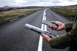
Accurate and reliable IoT-based sensors can be placed anywhere and do not require significant infrastructure.
These self-contained devices bring additional observational value between existing RWISs on the network and can also be used to build new networks that were not previously feasible.
Road weather stations are usually placed in fixed locations, making gathering accurate road weather data difficult. But by harnessing the power of the IoT to complement existing road weather station networks, road maintenance professionals can ensure roads are safe and efficient in all weather conditions while also improving maintenance operations, emergency response, and public transportation.
A road observation network that includes both fixed, battery-powered sensors and mobile sensors delivering consolidated data ultimately creates a complete observation system that enables the most efficient approach to road maintenance.
Combining disparate types of sensors in different locations gives decision makers a better perspective of an agency’s network and allows them to take advantage of all types of observations.
IoT devices can eliminate guesswork by allowing for the automated collection and analysis of real-time data.
Road weather modeling technologies optimize winter maintenance in challenging locations. These models simulate weather conditions and predict how they will impact road conditions in specific areas, allowing for proactive maintenance operations. For example, by using road weather modeling, authorities can optimize salt application to prevent ice from forming, minimize resource loss, reduce the risk of accidents, and improve road safety.
The physical parameters that go into the model are vital to the its success. By combining those physical road weather attributes with weather information, models can forecast at the road surface level compared to a general weather forecast.
The future of road transportation is on the brink of a revolution, thanks to internet-connected sensors and systems. Accurate, reliable road weather data is the lifeblood of road safety and transportation efficiency, driving informed decision making to proactively safeguard our streets from inclement weather.
With cutting-edge IoT sensors and systems, the road maintenance industry can bridge gaps in data collection, particularly in challenging locations. And the future holds even more tremendous promise for IoT-based road weather systems. R&B
Leon Shneider is a senior sales manager at Vaisala. For more than 30 years, he has played an instrumental role in driving Vaisala’s global road weather business forward.


